
1948 Map of Hemingford 4 SW
USGS Topo · Published 1948About this map
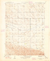
The High Plains of the Nebraska Panhandle are captured here just after the war, showing a landscape defined by water management and rural education. The arid terrain is dominated by the winding course of Snake Creek and Barrel Springs Creek, which carve through the Goodstrick area. This 1940s survey reveals the vital role of groundwater for local ranching, with numerous Windmills dotting the sections. Educational hubs serve the scattered population, including School No 22, School No 23, and School No 36. Near the county line separating Box Butte and Morrill counties, an Abandoned Canal serves as a silent reminder of earlier attempts to divert water across this prairie landscape, while the location of Bonner sits at the southern edge of the survey.
Find a feature on this map
10 named features on this map. Tap any name to fly to it.
Don’t see what you’re looking for? This feature index may not catch every label — zoom into the map to look around manually.
Map Details
Editions of this 1948 Hemingford 4 SW Map
4 editions found
Other maps of this area

1898 · Camp Clarke
USGS Topo · 1:125,000

1948 · Hemingford 4 SE
USGS Topo · 1:24,000

1948 · Hemingford 4 NE
USGS Topo · 1:24,000

1948 · Hemingford 4 NW
USGS Topo · 1:24,000

1951 · Kilpatrick Lake
USGS Topo · 1:62,500

1954 · Scottsbluff
USGS Topo · 1:250,000

1955 · Alliance
USGS Topo · 1:250,000

1957 · Alliance
USGS Topo · 1:250,000

1958 · Alliance
USGS Topo · 1:250,000

1958 · Scottsbluff
USGS Topo · 1:250,000