
Loading...
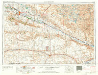
Loading map...1954 Map of Scottsbluff
USGS Topo · Published 1958About this map
Scotts Bluff National Monument and the prominent Wildcat Hills dominate the western landscape of this mid-century survey. The North Platte River serves as a primary corridor for both the Chicago Burlington & Quincey railroad and significant irrigation infrastructure, including Lake Minatare and Lake Alice. The map reveals a high concentration of landmark geological features that guided pioneers, such as Chimney Rock, Courthouse Rock, and Jail Rock.
Find a feature on this map
131 named features on this map. Tap any name to fly to it.
Don’t see what you’re looking for? This feature index may not catch every label — zoom into the map to look around manually.
Map Details
Date Portrayed1954
Date Published1958
PublisherU.S. Geological Survey
Map TypeTopographic
Scale1:250,000
Physical Dimensions28.7 x 22.1 inches
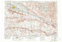
Editions of this 1954 Scottsbluff Map
3 editions found
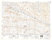
Historical Maps of Scottsbluff Through Time
3 maps found
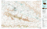
Featured Locations
Source Details
SourceU.S. Geological Survey
CopyrightPublic Domain