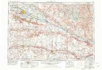
1954 Map of Scottsbluff
USGS Topo · Published 1978About this map
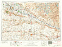
The North Platte River corridor anchors this mid-century western Nebraska landscape, serving as the lifeblood for a network of irrigation canals including the Tri-State Canal and Belmont Canal. The twin cities of Scottsbluff and Gering sit at the center of this agricultural valley, shadowed by the iconic geological formations of Scotts Bluff and the Wildcat Hills. Notable landmarks such as Chimney Rock and Courthouse Rock serve as historical beacons along the valley floor, while the surrounding tablelands transition into the vast Sand Hills to the north and the Oil Field regions near Kimball and Sidney to the south. Transportation infrastructure is defined by the Union Pacific and Burlington Northern railroads, which parallel major transit routes like U.S. 30 and the emerging I-80. Conservation areas like the Crescent Lake National Wildlife Refuge preserve the numerous small lakes scattered across the northern dunes.
Find a feature on this map
75 named features on this map. Tap any name to fly to it.
Don’t see what you’re looking for? This feature index may not catch every label — zoom into the map to look around manually.
Map Details
Editions of this 1954 Scottsbluff Map
3 editions found

Other maps of this area

1896 · Patrick
USGS Topo · 1:125,000

1896 · Browns Creek
USGS Topo · 1:125,000

1897 · Ogallala
USGS Topo · 1:125,000

1898 · Scotts Bluff
USGS Topo · 1:125,000

1898 · Camp Clarke
USGS Topo · 1:125,000

1899 · Browns Creek
USGS Topo · 1:125,000

1899 · Sidney
USGS Topo · 1:125,000

1899 · Goshen Hole
USGS Topo · 1:125,000

1899 · Whistle Creek
USGS Topo · 1:125,000

1900 · Chappell
USGS Topo · 1:125,000