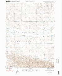
1948 Map of Barrel Springs Creek South
USGS Topo · Published 1993About this map
The High Plains of western Nebraska are defined here by the seasonal drainage patterns of Snake Creek and Barrel Springs Creek, mapped during the mid-1940s before modern irrigation shifted the agricultural profile of the region. This survey, conducted by the Bureau of Reclamation and the Geological Survey, reveals a sparsely populated landscape organized around rural education and water management. The presence of several one-room schoolhouses, including School No 22, School No 28, and School No 36, indicates the density of farmstead families living in the panhandle at the time.
Find a feature on this map
12 named features on this map. Tap any name to fly to it.
Don’t see what you’re looking for? This feature index may not catch every label — zoom into the map to look around manually.
Map Details
Editions of this 1948 Barrel Springs Creek South Map
4 editions found
Other maps of this area

1898 · Camp Clarke
USGS Topo · 1:125,000

1948 · Hemingford 4 SW
USGS Topo · 1:24,000

1948 · Hemingford 4 SE
USGS Topo · 1:24,000

1948 · Hemingford 4 NE
USGS Topo · 1:24,000

1948 · Hemingford 4 NW
USGS Topo · 1:24,000

1951 · Kilpatrick Lake
USGS Topo · 1:62,500

1954 · Scottsbluff
USGS Topo · 1:250,000

1955 · Alliance
USGS Topo · 1:250,000

1957 · Alliance
USGS Topo · 1:250,000

1958 · Alliance
USGS Topo · 1:250,000