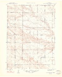
1948 Map of Hemingford 4 NW
USGS Topo · Published 1948About this map
The High Plains of Box Butte County are defined here by a sparse but organized network of rural education and water management during the post-war era. The landscape is divided between the townships of Liberty and Wright, where a series of numbered schoolhouses, including School No 51, School No 19, and School No 8, served the scattered ranching families of the region. These small educational outposts are often the only structural landmarks in a territory dominated by drainage systems like Nonpareil Creek and the South Branch of the Niobrara river system.
Find a feature on this map
13 named features on this map. Tap any name to fly to it.
Don’t see what you’re looking for? This feature index may not catch every label — zoom into the map to look around manually.
Map Details
Editions of this 1948 Hemingford 4 NW Map
3 editions found
Other maps of this area

1946 · Nonpareil
USGS Topo · 1:24,000

1948 · Hemingford
USGS Topo · 1:24,000

1948 · Hemingford 4 SW
USGS Topo · 1:24,000

1948 · Hemingford 4 SE
USGS Topo · 1:24,000

1948 · Hemingford 4 NE
USGS Topo · 1:24,000

1948 · Hemingford 4 NW
USGS Topo · 1:24,000

1948 · Nonpareil
USGS Topo · 1:24,000

1951 · Marsland
USGS Topo · 1:62,500

1951 · Kilpatrick Lake
USGS Topo · 1:62,500

1955 · Alliance
USGS Topo · 1:250,000