
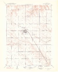
1948 Map of Hemingford
USGS Topo · Published 1948About this map
Hemingford sits as the central hub of this High Plains landscape, situated at the junction of the Chicago Burlington and Quincy railroad and local rural routes. The town is flanked by essential community infrastructure including the Landing Field and the Hemingford Cem, while the surrounding prairie is divided into the districts of Dorsey and Nonpareil.
Find a feature on this map
16 named features on this map. Tap any name to fly to it.
Don’t see what you’re looking for? This feature index may not catch every label — zoom into the map to look around manually.
Map Details
Editions of this 1948 Hemingford Map
2 editions found
Other maps of this area

1946 · Nonpareil
USGS Topo · 1:24,000

1946 · Box Butte Reservoir West
USGS Topo · 1:24,000

1947 · Box Butte NW
USGS Topo · 1:24,000

1948 · Box Butte Reservoir West
USGS Topo · 1:24,000

1948 · Berea Creek West
USGS Topo · 1:24,000

1948 · Hemingford 4 NE
USGS Topo · 1:24,000

1948 · Hemingford 4 NW
USGS Topo · 1:24,000

1948 · Nonpareil
USGS Topo · 1:24,000

1948 · Box Butte Reservoir East
USGS Topo · 1:24,000

1949 · Box Butte SW
USGS Topo · 1:24,000