
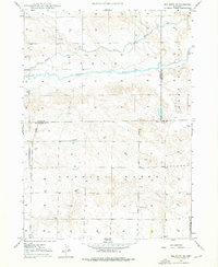
1947 Map of Box Butte NW
USGS Topo · Published 1977About this map
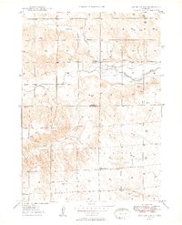
The Niobrara River carves a deep path across this high plains landscape at the border of Dawes and Box Butte Counties. This 1947 topography reveals an area defined by agricultural water management and sparse upland settlements, characterized by the winding routes of the Mirage Flats Canal and the Potmesil Canal. Notable for its scientific and local history, the map identifies the Fossil Beds in the southwest and the Kattn Cem to the east.
Find a feature on this map
14 named features on this map. Tap any name to fly to it.
Don’t see what you’re looking for? This feature index may not catch every label — zoom into the map to look around manually.
Map Details
Editions of this 1947 Box Butte NW Map
This is the sole edition of this map. No revisions or reprints were ever made.
Other maps of this area
1947 · Box Butte NE
USGS Topo · 1:24,000

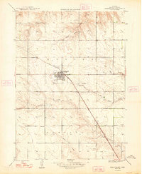
1947 · Box Butte
USGS Topo · 1:24,000
1948 · Hemingford
USGS Topo · 1:24,000

1948 · Box Butte Reservoir East
USGS Topo · 1:24,000
1949 · Box Butte NE
USGS Topo · 1:24,000
1949 · Box Butte SW
USGS Topo · 1:24,000

1949 · Box Butte
USGS Topo · 1:24,000
1949 · Box Butte NW
USGS Topo · 1:24,000

1955 · Alliance
USGS Topo · 1:250,000

1957 · Alliance
USGS Topo · 1:250,000