
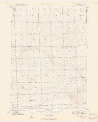
1949 Map of Box Butte
USGS Topo · Published 1949About this map
Wild Horse Butte and the surrounding high plains of the Nebraska Panhandle define this landscape as it was documented in the late 1940s. The topography, mapped via plane-table methods, reveals a sparse but organized pastoral environment marked by the ephemeral drainage of Box Butte Creek. This survey captures the rural infrastructure of the era, where one-room schoolhouses like School No 46 and School No 15 served as the primary social and educational hubs for widely scattered ranching families. The terrain transitions into the area known as Running Water, a name suggesting the vital importance of seasonal water sources in this semi-arid region. Located along the boundary of Box Butte County and Sheridan County, the map provides a precise look at section lines and land divisions before modern agricultural shifts.
Find a feature on this map
8 named features on this map. Tap any name to fly to it.
Don’t see what you’re looking for? This feature index may not catch every label — zoom into the map to look around manually.
Map Details
Editions of this 1949 Box Butte Map
2 editions found
Other maps of this area

1946 · Berea Creek East
USGS Topo · 1:24,000

1947 · Box Butte NE
USGS Topo · 1:24,000

1947 · Box Butte
USGS Topo · 1:24,000

1947 · Box Butte NW
USGS Topo · 1:24,000

1948 · Berea Creek West
USGS Topo · 1:24,000

1948 · Berea Creek East
USGS Topo · 1:24,000

1948 · Antioch
USGS Topo · 1:62,500

1949 · Box Butte NE
USGS Topo · 1:24,000

1949 · Box Butte SW
USGS Topo · 1:24,000

1949 · Antioch
USGS Topo · 1:62,500