
1947 Map of Box Butte NE
USGS Topo · Published 1976About this map
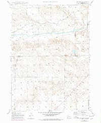
The Niobrara River meanders across this high plains landscape, defining the character of the borderlands between Dawes, Sheridan, and Box Butte counties. This 1947 topographic survey, published decades later by the Bureau of Reclamation, reveals the early infrastructure of the Irrigation Canal systems that were vital to agriculture in the Nebraska panhandle. Beyond the river valley, the terrain is characterized by broad plateaus like Running Water and Mirage, dotted with numerous Windmills that served isolated homesteads and livestock. Rural education is anchored by School No 80, a critical landmark for local genealogists tracing family footprints in this expansive ranching country. The map captures the quiet, systematic development of water resources along Pepper Creek and the river, showing the transition from open range to a more managed agrarian landscape.
Find a feature on this map
13 named features on this map. Tap any name to fly to it.
Don’t see what you’re looking for? This feature index may not catch every label — zoom into the map to look around manually.
Map Details
Editions of this 1947 Box Butte NE Map
2 editions found
Other maps of this area

1947 · Box Butte
USGS Topo · 1:24,000

1947 · Box Butte NW
USGS Topo · 1:24,000

1949 · Box Butte NE
USGS Topo · 1:24,000

1949 · Box Butte SW
USGS Topo · 1:24,000

1949 · Box Butte
USGS Topo · 1:24,000

1949 · Box Butte NW
USGS Topo · 1:24,000

1950 · Skunk Lake
USGS Topo · 1:62,500

1955 · Alliance
USGS Topo · 1:250,000

1957 · Alliance
USGS Topo · 1:250,000

1958 · Alliance
USGS Topo · 1:250,000