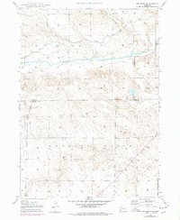
1947 Map of Box Butte NE
USGS Topo · Published 1977About this map
Niobrara River winds through the northern half of this landscape, flanked by the distinct terrain of Mirage Flats and the narrow corridor of Sand Canyon. Topography compiled in the late 1940s reveals an agrarian landscape defined by essential water infrastructure, most notably the Mirage Flats Canal and several scattered windmills. These features, along with intermittent streams like Pepper Creek, underscore the vital role of irrigation and water management in this corner of the Nebraska panhandle.
Find a feature on this map
14 named features on this map. Tap any name to fly to it.
Don’t see what you’re looking for? This feature index may not catch every label — zoom into the map to look around manually.
Map Details
Editions of this 1947 Box Butte NE Map
2 editions found
Other maps of this area

1947 · Box Butte NE
USGS Topo · 1:24,000

1947 · Box Butte
USGS Topo · 1:24,000

1947 · Box Butte NW
USGS Topo · 1:24,000

1949 · Box Butte NE
USGS Topo · 1:24,000

1949 · Box Butte SW
USGS Topo · 1:24,000

1949 · Box Butte
USGS Topo · 1:24,000

1949 · Box Butte NW
USGS Topo · 1:24,000

1950 · Skunk Lake
USGS Topo · 1:62,500

1955 · Alliance
USGS Topo · 1:250,000

1957 · Alliance
USGS Topo · 1:250,000