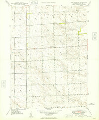
1949 Map of Box Butte SW
USGS Topo · Published 1949About this map
Running Water and Nonpareil define the high plains landscape of Box Butte County in this mid-century topographic record. The terrain is characterized by a network of seasonal drainages including the North Branch and South Branch, which converge as they move through the central sections of the quadrangle. The Bureau of Reclamation was actively involved in this region, which was mapped via aerial photographs taken in 1939 and updated with plane-table methods in 1947.
Find a feature on this map
9 named features on this map. Tap any name to fly to it.
Don’t see what you’re looking for? This feature index may not catch every label — zoom into the map to look around manually.
Map Details
Editions of this 1949 Box Butte SW Map
2 editions found

Other maps of this area

1946 · Berea Creek East
USGS Topo · 1:24,000

1947 · Box Butte NE
USGS Topo · 1:24,000

1947 · Box Butte
USGS Topo · 1:24,000

1947 · Box Butte NW
USGS Topo · 1:24,000

1948 · Hemingford
USGS Topo · 1:24,000

1948 · Berea Creek West
USGS Topo · 1:24,000

1948 · Berea Creek East
USGS Topo · 1:24,000

1948 · Hemingford 4 NE
USGS Topo · 1:24,000

1948 · Box Butte Reservoir East
USGS Topo · 1:24,000

1949 · Box Butte NE
USGS Topo · 1:24,000