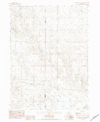
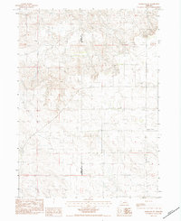
1983 Map of Kilpatrick Lake NW
USGS Topo · Published 1984About this map
Ranching operations define this 1980s landscape on the border of Sioux and Box Butte counties. The terrain is shaped by the intermittent drainage of the Snake Creek system, where the North Branch Snake River and South Branch Snake River converge amidst a network of unimproved roads and cattle trails. This provisional survey captures the distribution of legacy family holdings, such as the Hood Ranch, Locker Ranch, and the neighboring E Henderson Ranch and I B Henderson Ranch. The map reveals a land management pattern dependent on natural water sources like Mud Springs Creek and various unnamed springs. Aside from a lone Gravel Pit, the area remains focused on livestock production, showing the sparse but intentional infrastructure of the Nebraska panhandle’s high plains during this era.
Find a feature on this map
11 named features on this map. Tap any name to fly to it.
Don’t see what you’re looking for? This feature index may not catch every label — zoom into the map to look around manually.
Map Details
Editions of this 1983 Kilpatrick Lake NW Map
This is the sole edition of this map. No revisions or reprints were ever made.
Other maps of this area

1899 · Whistle Creek
USGS Topo · 1:125,000

1951 · Marsland
USGS Topo · 1:62,500

1951 · Kilpatrick Lake
USGS Topo · 1:62,500

1955 · Alliance
USGS Topo · 1:250,000

1957 · Alliance
USGS Topo · 1:250,000

1958 · Alliance
USGS Topo · 1:250,000
1983 · Marsland SE
USGS Topo · 1:24,000
1983 · University Lake SE
USGS Topo · 1:24,000
1983 · Kilpatrick Lake
USGS Topo · 1:24,000
1983 · Marsland SW
USGS Topo · 1:24,000