Old Maps of Whistle Creek Precinct, Nebraska
Explore 83 old maps of Whistle Creek Precinct, spanning from 1899 to today. These high-resolution historic maps reveal how streets, neighborhoods, landmarks, and natural features evolved over time — perfect for genealogy, metal detecting, research, and local history exploration.
What you can do with these maps:
- See how Whistle Creek Precinct changed over time: Compare historical maps to modern-day views to trace roads, homesites, rail lines & more.
- View detailed metadata: Each map includes creators, publishers, year, scale, and archive source.
- Overlay maps with satellite & LiDAR: Visualize the past alongside modern tools to explore terrain & human change.
- Trusted historical sources: Maps sourced from the USGS, Library of Congress, and other archives.
- Access maps your way: View online, download high-res files, or order prints for personal or research use.
Start exploring old maps of Whistle Creek Precinct to uncover forgotten places, hidden landmarks, and the deep history beneath your feet.
Whistle Creek Precinct, NE maps
(83)- 1899 Map of Whistle Creek
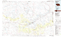
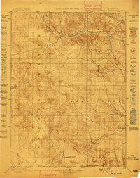 1899 Whistle Creek1899 Print · USGSSioux County's ranching frontier is frozen in time during the late nineteenth century, showing a landscape where water meant survival. Genealogists and historians can trace old wagon routes like the Spottedtail Trail and find early cattle outposts like Agate and Corbin's Ranch.4 unique versions available
 - 1951 Map of Marsland
 1951 Marsland1951 Print · USGSThe High Plains of Box Butte County are captured here in the early fifties, centered on the railroad town of Marsland. Genealogists and local historians can trace a vanished rural school system through sites like School No 26 and locate family landmarks such as St Marys Ch.3 unique versions available
 - 1951 Map of Kilpatrick Lake
 1951 Kilpatrick Lake1951 Print · USGSIn the mid-century ranchlands of western Nebraska, the landscape is defined by family homesteads and the vital waters of Snake Creek. Researchers can trace the heritage of local estates like Hall Ranch and Henderson Ranch or locate the Severson Cem.2 unique versions available
 - 1955 Map of Alliance, 1966 Print
 1955 Alliance1966 Print · USGSThe Nebraska panhandle comes into sharp focus during the mid-fifties, showing a landscape defined by the Niobrara River and the expanding Sand Hills. Researchers can trace the grounds of Fort Robinson, locate Saint Marys Church, or follow the Chicago Burlington and Quincy rail line through Hemingford.3 unique versions available
 - 1957 Map of Alliance
 1957 Alliance1957 Print · USGSNorthwest Nebraska in the mid-fifties is captured here as a landscape of rail hubs, sprawling cattle ranches, and the eastern edge of the dunes. Genealogists and historians can trace rail lines through Alliance and Chadron or locate landmarks like Saint Marys Church and the Agate Spring Fossil Beds.
 - 1958 Map of Alliance
 1958 Alliance1958 Print · USGSNorthwestern Nebraska in the late fifties shows a landscape shaped by the legacy of the high plains frontier and modern agricultural expansion. Genealogists and historians can trace rail-line settlements and landmarks like Fort Robinson and the Agate Spring Fossil Beds.
 - 1979 Map of Harrison SE
 1979 Harrison SE1979 Print · USGSSioux County rangeland in the late 1970s reveals a spare landscape of high plains ranching and remote outposts. Researchers can trace the network of unimproved roads and livestock infrastructure, including the settlement at Buckley, a prominent northern Trail, and numerous vital Well sites.
 - 1979 Map of Mount Edna
 1979 Mount Edna1979 Print · USGSThe high plains of Sioux County are captured in the late seventies, showing a quiet landscape of ranching and remote outposts. Researchers can identify the exact locations of family-run water points and the small settlement of Royville near Mount Edna and the Flat.
 - 1979 Map of Agate
 1979 Agate1979 Print · USGSSioux County's fossil-rich river valley is captured here in the late 1970s, focused on the paleontological landscape. Genealogists and researchers can trace local landmarks like the Grandview Sch and the settlement of Agate along the Niobrara River.
 - 1980 Map of Kyle Creek, 1981 Print
 1980 Kyle Creek1981 Print · USGSIn Sioux County during the 1980s, the White River corridor served as the primary artery for the Chicago and North Western railroad. Trace the local rural infrastructure at Hillview Sch and follow the branching waters of Kyle Creek and Borngrover Creek.
 - 1980 Map of Dead Mans Creek, 1981 Print
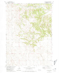
 1980 Dead Mans Creek1981 Print · USGSDawes and Sioux Counties appear here in the early eighties as a landscape of timbered ridges and public land. Researchers can trace the rugged drainages of Dead Mans Creek and Starvation Gulch or locate the Cochran State Wayside Area along the forest boundary.
 - 1980 Map of Glen, 1981 Print
 1980 Glen1981 Print · USGSSioux County ranch lands and rail corridors are captured here in the late seventies. Family historians can locate the Glendale Cem and District No 33 Sch along the river valley near the Chicago and North Western railroad.
 - 1983 Map of Kilpatrick Lake NW, 1984 Print
 1983 Kilpatrick Lake NW1984 Print · USGSThe high plains on the Sioux and Box Butte county line appear here in the early 1980s as a land of expansive cattle operations. Genealogists and local historians can trace legacy family holdings such as the Hood Ranch, Locker Ranch, and I B Henderson Ranch along the winding Snake Creek.
 - 1983 Map of Marsland SW, 1984 Print
 1983 Marsland SW1984 Print · USGSWestern Nebraska's high plains transition into rugged ranchland in the early 1980s. Local history researchers can locate family sites like the Bohemian Pioneer Cem and trace the survey line of Sioux Co Box Butte Co.
 - 1983 Map of University Lake NW, 1984 Print
 1983 University Lake NW1984 Print · USGSSioux County ranching country is captured here during the early eighties, showing the spread of family operations across the high plains. Researchers can locate specific homesteads like the Watson Ranch and Spear-Diamond Ranch or trace the course of Spottedtail Creek.
 - 1983 Map of Marsland NW, 1984 Print
 1983 Marsland NW1984 Print · USGSNorthwest Nebraska in the early 1980s shows a landscape defined by the winding Niobrara River and the rugged heights of Pine Ridge. Researchers can trace the boundaries of Sioux, Dawes, and Box Butte counties and locate various Irr Wells and Wells across the plains.
 - 1983 Map of University Lake NE, 1984 Print
 1983 University Lake NE1984 Print · USGSSioux County ranchlands are captured here in the early 1980s, showcasing the high-plains terrain of the Nebraska Sandhills. Researchers can trace the layout of the Elliott Ranch and Henderson Ranch, as well as a lonely Grave and the headwaters of Mud Spr Cr.
 - 1983 Map of Whistle Creek NW, 1984 Print
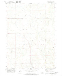
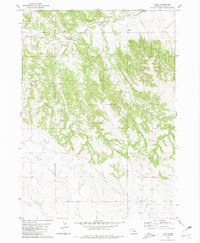
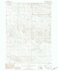
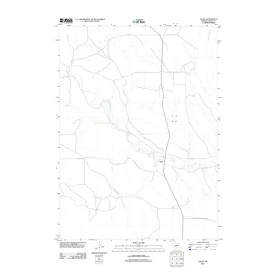
 1983 Whistle Creek NW1984 Print · USGSSioux County's high plains were carefully documented in the early 1980s, revealing a landscape of scientific discovery and essential irrigation. Researchers can trace the winding Niobrara River and explore landmarks within Agate Fossil Beds National Monument including University Hill.
 - 1983 Map of Whistle Creek SW, 1984 Print
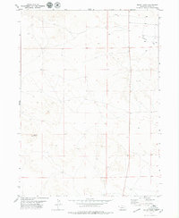
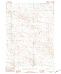
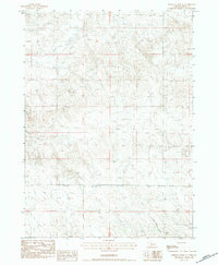
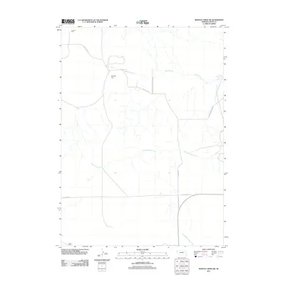
 1983 Whistle Creek SW1984 Print · USGSSioux County's high plains were a landscape of managed water and ranching during the early 1980s. Researchers can locate the Johnson Ranch and trace the paths of Coyote Springs Creek and the expansive Royville Flat.
 - 1983 Map of Whistle Creek SE, 1984 Print
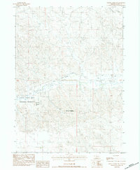
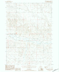
 1983 Whistle Creek SE1984 Print · USGSThe Sioux County high plains are captured in the early eighties as a landscape of isolated ranching and water management. Researchers can trace land markers like Curly Sch, a solitary Grave, and the winding Whistle Creek.
 - 1983 Map of Whistle Creek NE, 1984 Print
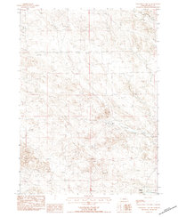
 1983 Whistle Creek NE1984 Print · USGSSioux County in the early 1980s reveals a landscape of high plains ranching and vital water management along the Niobrara River. Researchers can trace the path of Whistle Creek and locate local landmarks like Pink Sch and the Mentlen Ditch.
 - 1985 Map of Hemingford, 1986 Print
 1985 Hemingford1986 Print · USGSThe Nebraska panhandle comes into sharp focus during the mid-1980s, revealing a landscape of remote ranching outposts and paleontological significance. Researchers can trace the Niobrara River to the Agate Fossil Beds National Monument or locate early settlements like Nonpareil and Marsland.2 unique versions available
 - 1986 Map of Crawford
 1986 Crawford1986 Print · USGSThe Nebraska Panhandle in the mid-eighties shows a high-plains landscape defined by its rugged geology and major rail corridors. Genealogists and historians can trace the paths of the Burlington Northern railroad through settlements like Orella, Glen, and Harrison.2 unique versions available
 - 2011 Map of Agate, 2011 Print
 2011 Agate2011 Print · USGSCovers Whistle Creek Precinct, including Agate, Bowen Precinct, and other nearby areas
 - 2011 Map of Whistle Creek SW, 2011 Print
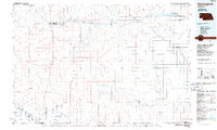
 2011 Whistle Creek SW2011 Print · USGSCovers Whistle Creek Precinct, including Sheep Creek Precinct, Sioux County, and other nearby areas
Showing maps 1-25 of 83
Top neighborhoods of Whistle Creek Precinct
Frequently asked questions
- What are the different types of historical maps available for Whistle Creek Precinct?
- What is the oldest map of Whistle Creek Precinct?
- Where can I purchase historical maps of Whistle Creek Precinct for my home or office?
- Where can I download high-res historical maps of Whistle Creek Precinct?
- Are there historical topographic maps available for Whistle Creek Precinct?
- Is there historical aerial imagery available for Whistle Creek Precinct?
- Where are historical maps of Whistle Creek Precinct sourced from?