Old Maps of Agate, Whistle Creek Precinct
Explore 10 old maps of Agate, spanning from 1899 to today. These high-resolution historic maps reveal how streets, neighborhoods, landmarks, and natural features evolved over time — perfect for genealogy, metal detecting, research, and local history exploration.
What you can do with these maps:
- See how Agate changed over time: Compare historical maps to modern-day views to trace roads, homesites, rail lines & more.
- View detailed metadata: Each map includes creators, publishers, year, scale, and archive source.
- Overlay maps with satellite & LiDAR: Visualize the past alongside modern tools to explore terrain & human change.
- Trusted historical sources: Maps sourced from the USGS, Library of Congress, and other archives.
- Access maps your way: View online, download high-res files, or order prints for personal or research use.
Start exploring old maps of Agate to uncover forgotten places, hidden landmarks, and the deep history beneath your feet.
Agate, Whistle Creek Precinct maps
(10)- 1899 Map of Whistle Creek
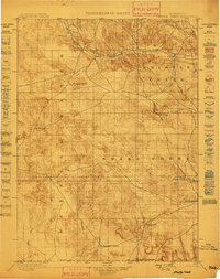 1899 Whistle Creek1899 Print · USGSSioux County's ranching frontier is frozen in time during the late nineteenth century, showing a landscape where water meant survival. Genealogists and historians can trace old wagon routes like the Spottedtail Trail and find early cattle outposts like Agate and Corbin's Ranch.4 unique versions available
 - 1955 Map of Alliance, 1966 Print
 1955 Alliance1966 Print · USGSThe Nebraska panhandle comes into sharp focus during the mid-fifties, showing a landscape defined by the Niobrara River and the expanding Sand Hills. Researchers can trace the grounds of Fort Robinson, locate Saint Marys Church, or follow the Chicago Burlington and Quincy rail line through Hemingford.3 unique versions available
 - 1957 Map of Alliance
 1957 Alliance1957 Print · USGSNorthwest Nebraska in the mid-fifties is captured here as a landscape of rail hubs, sprawling cattle ranches, and the eastern edge of the dunes. Genealogists and historians can trace rail lines through Alliance and Chadron or locate landmarks like Saint Marys Church and the Agate Spring Fossil Beds.
 - 1958 Map of Alliance
 1958 Alliance1958 Print · USGSNorthwestern Nebraska in the late fifties shows a landscape shaped by the legacy of the high plains frontier and modern agricultural expansion. Genealogists and historians can trace rail-line settlements and landmarks like Fort Robinson and the Agate Spring Fossil Beds.
 - 1979 Map of Agate
 1979 Agate1979 Print · USGSSioux County's fossil-rich river valley is captured here in the late 1970s, focused on the paleontological landscape. Genealogists and researchers can trace local landmarks like the Grandview Sch and the settlement of Agate along the Niobrara River.
 - 1985 Map of Hemingford, 1986 Print
 1985 Hemingford1986 Print · USGSThe Nebraska panhandle comes into sharp focus during the mid-1980s, revealing a landscape of remote ranching outposts and paleontological significance. Researchers can trace the Niobrara River to the Agate Fossil Beds National Monument or locate early settlements like Nonpareil and Marsland.2 unique versions available
 - 2011 Map of Agate, 2011 Print
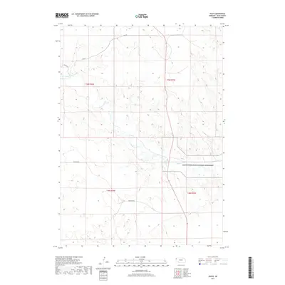
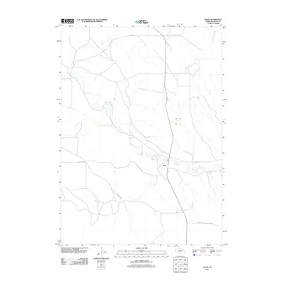 2011 Agate2011 Print · USGSCovers Agate, including Whistle Creek Precinct, Bowen Precinct, and other nearby areas
 - 2014 Map of Agate, 2014 Print
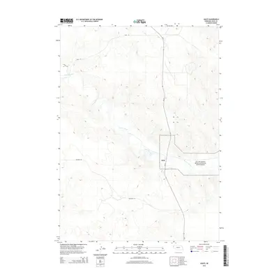 2014 Agate2014 Print · USGSCovers Agate, including Whistle Creek Precinct, Bowen Precinct, and other nearby areas
 - 2017 Map of Agate, 2017 Print
 2017 Agate2017 Print · USGSCovers Agate, including Whistle Creek Precinct, Bowen Precinct, and other nearby areas
 - 2021 Map of Agate, 2021 Print
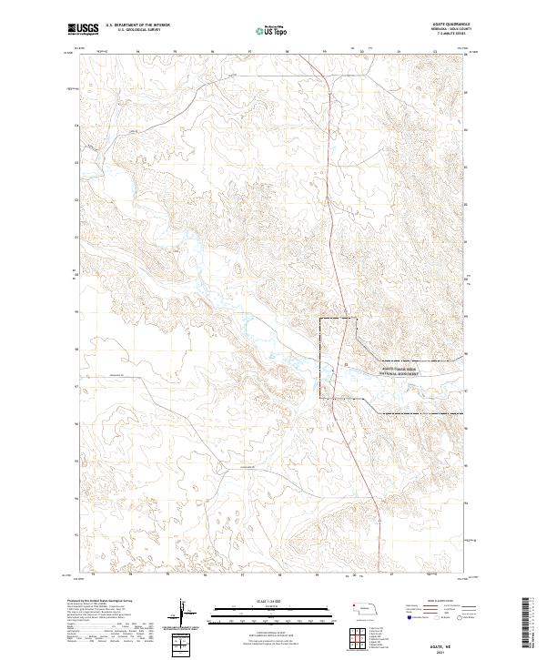 2021 Agate2021 Print · USGSSioux County ranchlands and paleontological sites are captured here in the early twenty-first century. Researchers can trace the path of the Niobrara River or locate the boundaries of the Agate Fossil Beds National Monument.
End of results
Showing maps 1-10 of 10
Frequently asked questions
- What are the different types of historical maps available for Agate?
- What is the oldest map of Agate?
- Where can I purchase historical maps of Agate for my home or office?
- Where can I download high-res historical maps of Agate?
- Are there historical topographic maps available for Agate?
- Is there historical aerial imagery available for Agate?
- Where are historical maps of Agate sourced from?