1970s Maps of Whistle Creek Precinct, Nebraska
Explore 3 historic maps of Whistle Creek Precinct from the 1970s. These maps offer a rare glimpse into what life looked like during the 1970s — showing old roads, neighborhoods, homes, and landmarks that have changed or disappeared over time.
Whether you're researching your family's past, planning a metal detecting trip, or studying how Whistle Creek Precinct's landscape evolved across the 1970s, these high-resolution maps are a powerful tool for exploring the history of this region.
- Focus on a specific era: All maps on this page are from the 1970s, giving you a focused view of this time period.
- See what’s changed: Compare century-old streets, trails, and buildings to today's modern landscape using overlays and satellite layers.
- Research with precision: Use these maps for genealogy, historical research, land use analysis, or educational projects.
- View, download, or print: Maps are fully viewable online in high resolution, and can be downloaded or printed for your own records.
Start exploring Whistle Creek Precinct's history through authentic maps from the 1970s. This is your window into the past.
Whistle Creek Precinct, NE maps
(3)- 1979 Map of Harrison SE
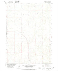 1979 Harrison SE1979 Print · USGSSioux County rangeland in the late 1970s reveals a spare landscape of high plains ranching and remote outposts. Researchers can trace the network of unimproved roads and livestock infrastructure, including the settlement at Buckley, a prominent northern Trail, and numerous vital Well sites.
 - 1979 Map of Mount Edna
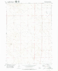 1979 Mount Edna1979 Print · USGSThe high plains of Sioux County are captured in the late seventies, showing a quiet landscape of ranching and remote outposts. Researchers can identify the exact locations of family-run water points and the small settlement of Royville near Mount Edna and the Flat.
 - 1979 Map of Agate
 1979 Agate1979 Print · USGSSioux County's fossil-rich river valley is captured here in the late 1970s, focused on the paleontological landscape. Genealogists and researchers can trace local landmarks like the Grandview Sch and the settlement of Agate along the Niobrara River.
End of results
Showing maps 1-3 of 3
Top neighborhoods of Whistle Creek Precinct
Frequently asked questions
- What are the different types of historical maps available for Whistle Creek Precinct?
- What is the oldest map of Whistle Creek Precinct?
- Where can I purchase historical maps of Whistle Creek Precinct for my home or office?
- Where can I download high-res historical maps of Whistle Creek Precinct?
- Are there historical topographic maps available for Whistle Creek Precinct?
- Is there historical aerial imagery available for Whistle Creek Precinct?
- Where are historical maps of Whistle Creek Precinct sourced from?