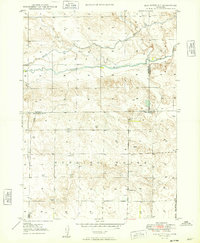
1949 Map of Box Butte NE
USGS Topo · Published 1949About this map
Niobrara River flows through a landscape defined by its agricultural utility and the intersection of three counties during the late 1940s. The northern portion of the region is characterized by water management systems, including an Irrigation Canal and a secondary Canal that tap into the river's resources. Further north, the drainage of Pepper Creek cuts through the terrain. The map captures a moment when rural education was localized at sites like School No 80, a critical landmark for genealogists tracing early families in this corner of Nebraska. The proliferation of the Windmill label across the townships highlights the necessity of groundwater for ranching and homesteading in this semi-arid environment, providing a detailed look at the physical infrastructure of mid-century high plains life at the borders of Box Butte, Dawes, and Sheridan counties.
Find a feature on this map
12 named features on this map. Tap any name to fly to it.
Don’t see what you’re looking for? This feature index may not catch every label — zoom into the map to look around manually.
Map Details
Editions of this 1949 Box Butte NE Map
2 editions found
Other maps of this area

1947 · Box Butte NE
USGS Topo · 1:24,000

1947 · Box Butte
USGS Topo · 1:24,000

1947 · Box Butte NW
USGS Topo · 1:24,000

1949 · Box Butte NE
USGS Topo · 1:24,000

1949 · Box Butte SW
USGS Topo · 1:24,000

1949 · Box Butte
USGS Topo · 1:24,000

1949 · Box Butte NW
USGS Topo · 1:24,000

1950 · Skunk Lake
USGS Topo · 1:62,500

1955 · Alliance
USGS Topo · 1:250,000

1957 · Alliance
USGS Topo · 1:250,000