2022 Map of Henderson
USGS Topo · Published 2022About this map
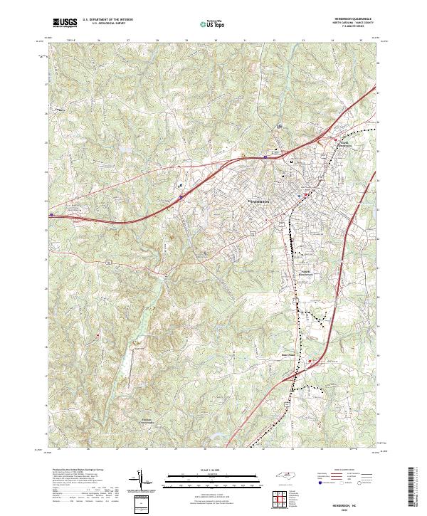
The Vance County Courthouse serves as the central anchor for Henderson in this contemporary 2022 survey, reflecting the city's established role as a regional hub. The urban center is surrounded by distinct residential and commercial districts, including North Henderson and South Henderson, while outlying communities like Dabney and Floytan Crossroads maintain a more rural character. The landscape is defined by a dense network of small waterways such as Ruin Cr, Nutbush Cr, and Little Cr that weave through the undulating terrain.
Find a feature on this map
225 named features on this map. Tap any name to fly to it.
Don’t see what you’re looking for? This feature index may not catch every label — zoom into the map to look around manually.
Map Details
Editions of this 2022 Henderson Map
This is the sole edition of this map. No revisions or reprints were ever made.
Historical Maps of North Henderson Through Time
4 maps found