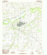
1984 Map of Henrietta
USGS Topo · Published 1985About this map
Henrietta serves as the central hub of this Clay County landscape, positioned where the Little Wichita River and the Dry Fork Little Wichita River converge. The town's grid is well-defined, bordered by industrial and municipal infrastructure including a Filtration Plant and Sewage Disposal Ponds near the riverbanks. To the north, Henrietta Lake provides a significant water feature amidst the rolling terrain, while an Old Railroad Grade cutting across the landscape northwest of the town center hints at the historical transportation corridors that once linked this region to larger markets.
Find a feature on this map
14 named features on this map. Tap any name to fly to it.
Don’t see what you’re looking for? This feature index may not catch every label — zoom into the map to look around manually.
Map Details
Editions of this 1984 Henrietta Map
This is the sole edition of this map. No revisions or reprints were ever made.
Other maps of this area

1954 · Wichita Falls
USGS Topo · 1:250,000

1956 · Henrietta
USGS Topo · 1:62,500

1957 · Wichita Falls East
USGS Topo · 1:62,500

1958 · Wichita Falls
USGS Topo · 1:250,000

1963 · Deer Creek
USGS Topo · 1:24,000
1968 · Bellevue
USGS Topo · 1:24,000
1968 · Bluegrove
USGS Topo · 1:24,000
1972 · Dean
USGS Topo · 1:24,000
1972 · Jolly
USGS Topo · 1:24,000
1984 · Hurnville
USGS Topo · 1:24,000