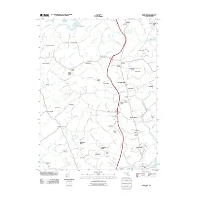
2011 Map of Hereford
USGS Topo · Published 2011About this map
The Gunpowder Falls river valley anchors this portion of Baltimore County, flowing southeast from the Prettyboy Dam toward the northern reaches of the Loch Raven Reservoir. This modern 2011 survey highlights a landscape where rural heritage and suburban development converge, evidenced by legacy landmarks like the Gunpowder Meetinghouse and the Bluemount Quarry. Significant infrastructure, including the Butler Post Office and Sparks Post Office, serves established communities such as Hereford and Belfast. The conversion of older rail corridors is visible in the Northern Central Trail, which follows the course of the Little Falls. Meanwhile, recreational and social history is represented by clusters like Camp Puh Tok and the Masonic Home of Maryland, reflecting the diverse land use throughout this undulating terrain.
Find a feature on this map
145 named features on this map. Tap any name to fly to it.
Don’t see what you’re looking for? This feature index may not catch every label — zoom into the map to look around manually.
Map Details
Editions of this 2011 Hereford Map
This is the sole edition of this map. No revisions or reprints were ever made.
Other maps of this area

1892 · Ellicott
USGS Topo · 1:62,500

1894 · Ellicott
USGS Topo · 1:62,500

1894 · Baltimore
USGS Topo · 1:62,500

1899 · Baltimore
USGS Topo · 1:62,500

1900 · Parkton
USGS Topo · 1:62,500

1902 · Parkton
USGS Topo · 1:62,500

1904 · Baltimore
USGS Topo · 1:62,500

1905 · Westminster
USGS Topo · 1:62,500

1906 · Ellicott
USGS Topo · 1:62,500

1908 · Patapsco
USGS Topo · 1:125,000