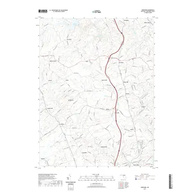
2019 Map of Hereford
USGS Topo · Published 2019About this map
Prettyboy Reservoir and its many western inlets like Prettyboy Cove dominate the northwest corner of this northern Baltimore County landscape. The area is defined by its deep stream valleys and the long, winding path of Gunpowder Falls, which draws a natural line through the rural settlements of Hereford and Glencoe. The transition from the rugged drainage patterns of Bush Cabin Run and Buffalo Cr to the more developed southern corridor near Hunt Valley reveals the ongoing evolution of the region's land use. Transportation history is deeply embedded in the terrain, seen in the conversion of old rail corridors into the Torrey C. Brown Rail Trail, which skirts the eastern edge of the map past Sparks. For local historians, the map preserves the names of numerous small hubs and family landmarks, from Bacon Hall and Priceville to Camp Alkor Spring.
Find a feature on this map
140 named features on this map. Tap any name to fly to it.
Don’t see what you’re looking for? This feature index may not catch every label — zoom into the map to look around manually.
Map Details
Editions of this 2019 Hereford Map
This is the sole edition of this map. No revisions or reprints were ever made.
Other maps of this area

1892 · Ellicott
USGS Topo · 1:62,500

1894 · Ellicott
USGS Topo · 1:62,500

1894 · Baltimore
USGS Topo · 1:62,500

1899 · Baltimore
USGS Topo · 1:62,500

1900 · Parkton
USGS Topo · 1:62,500

1902 · Parkton
USGS Topo · 1:62,500

1904 · Baltimore
USGS Topo · 1:62,500

1905 · Westminster
USGS Topo · 1:62,500

1906 · Ellicott
USGS Topo · 1:62,500

1908 · Patapsco
USGS Topo · 1:125,000