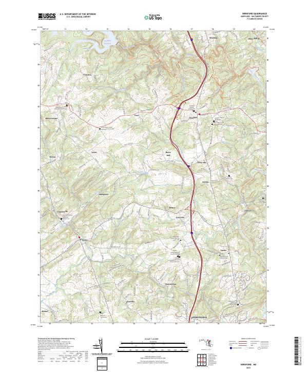
2023 Map of Hereford
USGS Topo · Published 2023About this map
Prettyboy Reservoir and its associated coves dominate the northwestern corner of this landscape, marking a significant water management feature within the rural Maryland countryside. The map reveals a high concentration of religious and community landmarks, such as the Gunpowder Friends Meeting House and the Geist Meeting House, reflecting a long-standing social fabric in settlements like Hereford and Sparks. The terrain is deeply incised by Gunpowder Falls and its many tributaries, including Bush Cabin Run and Western Run.
Find a feature on this map
163 named features on this map. Tap any name to fly to it.
Don’t see what you’re looking for? This feature index may not catch every label — zoom into the map to look around manually.
Map Details
Editions of this 2023 Hereford Map
This is the sole edition of this map. No revisions or reprints were ever made.
Other maps of this area

1892 · Ellicott
USGS Topo · 1:62,500

1894 · Ellicott
USGS Topo · 1:62,500

1894 · Baltimore
USGS Topo · 1:62,500

1899 · Baltimore
USGS Topo · 1:62,500

1900 · Parkton
USGS Topo · 1:62,500

1902 · Parkton
USGS Topo · 1:62,500

1904 · Baltimore
USGS Topo · 1:62,500

1905 · Westminster
USGS Topo · 1:62,500

1906 · Ellicott
USGS Topo · 1:62,500

1908 · Patapsco
USGS Topo · 1:125,000