2024 Map of Hiawassee
USGS Topo · Published 2024About this map
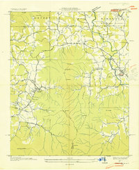
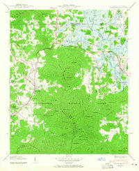
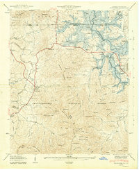
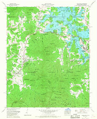
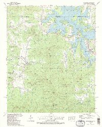
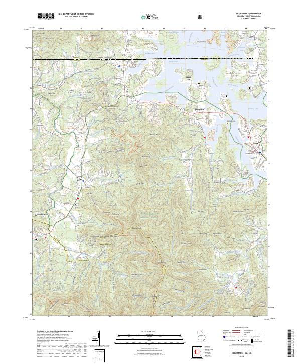
Hiawassee and Young Harris serve as the primary hubs in this corner of North Georgia, where the Appalachian landscape meets the waters of Chatuge Lake. The map reveals a high density of small family and community burial grounds, such as Old Burch Cem, Old Union Cem, and Sims Cem, providing invaluable data for genealogists tracing mountain lineages. The southern portion of the sheet is dominated by the protected heights of the Chattahoochee National Forest and the Brasstown Wilderness, featuring prominent landmarks like Chimney Top and Big Bald Cove. Educational and civic life centers on Young Harris College and the Towns County Courthouse, while the surrounding terrain is marked by numerous coves and gaps, including Norton Gap and McClure Cove, which have long dictated the path of travel and settlement in the Blue Ridge foothills.
Find a feature on this map
148 named features on this map. Tap any name to fly to it.
Don’t see what you’re looking for? This feature index may not catch every label — zoom into the map to look around manually.
Map Details
Editions of this 2024 Hiawassee Map
This is the sole edition of this map. No revisions or reprints were ever made.
Historical Maps of Jacksonville Through Time
6 maps found