Loading...
Loading map...2023 Map of Hicksville
USGS Topo · Published 2023About this map
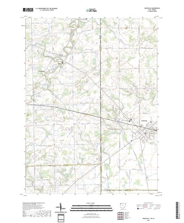
The Saint Joseph River winds through the northwestern corner of this landscape, marking the transition from Indiana into the Ohio agricultural heartland. The town of Hicksville serves as the primary hub in the east, where the local street grid meets the Hicksville Edgerton Rd. This modern survey reveals a highly managed landscape defined by an extensive network of drainage ditches, including Solshank Ditch, Melissa Ditch, and Nancy Davis Ditch, which support the surrounding farmland.
Find a feature on this map
92 named features on this map. Tap any name to fly to it.
Don’t see what you’re looking for? This feature index may not catch every label — zoom into the map to look around manually.
Map Details
Date Portrayed2023
Date Published2023
PublisherU.S. Geological Survey
Map TypeTopographic
Scale1:24000
Physical Dimensions24 x 29 inches
Editions of this 2023 Hicksville Map
This is the sole edition of this map. No revisions or reprints were ever made.
Historical Maps of Paulding County Through Time
Featured Locations
- Hicksville Township, OH
- Newville, IN
- Newville Center, IN
- Orangeville, IN
- Hicksville, Hicksville Township
Source Details
SourceU.S. Geological Survey
CopyrightPublic Domain