2022 Map of Hiddenite
USGS Topo · Published 2022About this map
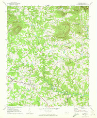
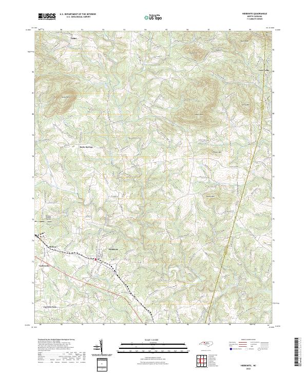
Hiddenite serves as the focal point for this survey of the Piedmont region in Alexander County, where the South Yadkin River and its numerous tributaries like Wallace Cr and Rocky Face Br carve through a landscape of prominent peaks. To the north, the terrain rises toward Rocky Face, Asbury Mtn, and Round Top, while the small settlement of Love Valley sits near the eastern boundary. The road network is heavily influenced by the topography, with family and community names preserved in routes such as Dishmon Family Dr and Jolly Farm Rd. Local history is anchored by sites like Vashti Church and Vashti Cemetery in the northwest, alongside the Gryder-Teague Airport near Midway. The map details the transition from the residential clusters of Fairview Park and Taylorsville in the southwest to the more dispersed rural character of the northern hills.
Find a feature on this map
146 named features on this map. Tap any name to fly to it.
Don’t see what you’re looking for? This feature index may not catch every label — zoom into the map to look around manually.
Map Details
Editions of this 2022 Hiddenite Map
This is the sole edition of this map. No revisions or reprints were ever made.