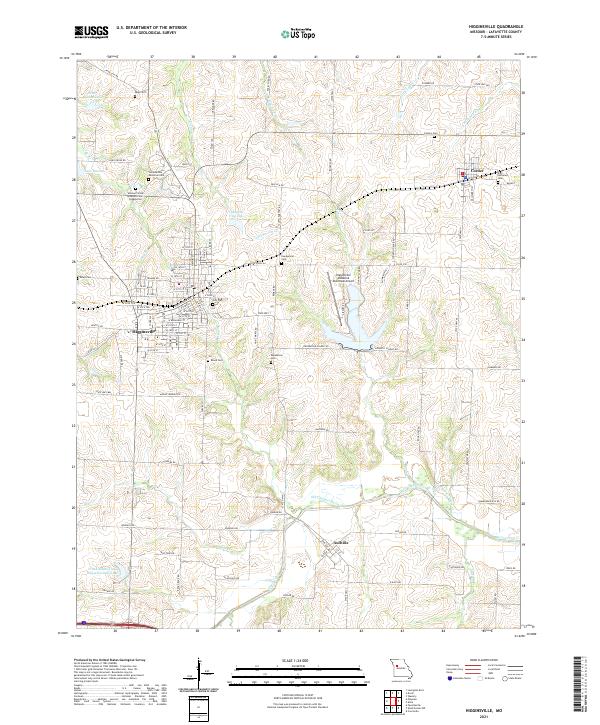
2021 Map of Higginsville
USGS Topo · Published 2021About this map
Higginsville serves as the primary hub of this Lafayette County landscape, where the town's dense street grid meets the rolling drainages of Davis Creek and Cottonwood Cr. The area is notably defined by its memorial sites, including the Confederate Memorial Cem and the Missouri State Veterans Cem Higginsville, which anchor the northern edge of the city. Beyond the urban limits, the map reveals a rural pattern of farm roads and scattered family and church burial grounds, such as Page Cem, Republican Cem, and Zion Lutheran Cem in Corder. Small reservoirs like Neher-Gibson Lake and Lake Mizzau dot the terrain, while the southern reaches of the map near Aullville show the winding path of the Old Channel Davis Cr, illustrating the hydrological modifications made to support local agriculture and industry.
Find a feature on this map
77 named features on this map. Tap any name to fly to it.
Don’t see what you’re looking for? This feature index may not catch every label — zoom into the map to look around manually.
Map Details
Editions of this 2021 Higginsville Map
This is the sole edition of this map. No revisions or reprints were ever made.
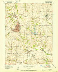
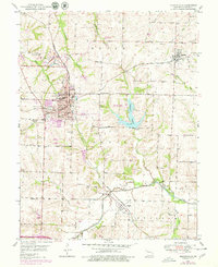
Historical Maps of Aullville Through Time
3 maps found