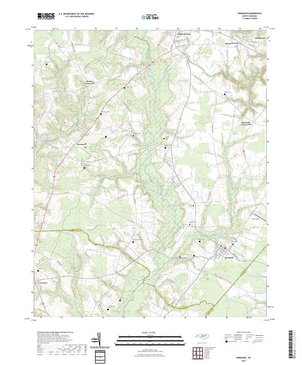
2022 Map of Hobgood
USGS Topo · Published 2022About this map
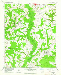
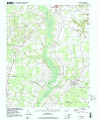
The town of Hobgood anchors this region of the coastal plain, where the local economy and geography are defined by its position at the intersection of several counties. Located at the meeting point of Halifax, Edgecombe, and Martin counties, the area is characterized by a high concentration of family cemeteries and crossroad settlements. These small community nodes, including Roseneath, Mullins Crossroads, and Braswells Crossroads, suggest a landscape historically tied to localized agriculture and lineage. Low-lying wetlands such as Cow Haul Swamp, Marsh Swamp, and Etheridge Swamp create natural divisions between the higher ground where these settlements and family plots, like the Leggett House Cem and Bland Cem, are situated. The presence of Ellis Airport and the street grid of Scotland Neck to the north indicate the continued modern development of these rural hubs within a traditional North Carolina landscape.
Find a feature on this map
72 named features on this map. Tap any name to fly to it.
Don’t see what you’re looking for? This feature index may not catch every label — zoom into the map to look around manually.
Map Details
Editions of this 2022 Hobgood Map
This is the sole edition of this map. No revisions or reprints were ever made.
Historical Maps of Mullins Crossroads Through Time
3 maps found