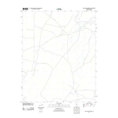
2011 Map of Hogansaani Spring
USGS Topo · Published 2011About this map
Hogansaani Spring and the drainage of Walker Creek define this arid landscape within the Shiprock Agency region. Surveyed in the early 21st century, the area is characterized by a sparse network of tribal and local roads. The intersection of Indian Rte 35 and various secondary routes such as Indian Rte 5054 and Indian Rte 5050 illustrates the essential transport corridors across the high desert terrain. In the western portion of the quadrangle, Apache Co 484 serves as a primary local artery. This topographical study captures a moment in the region's infrastructure prior to further modernization, focusing on the relationship between vital water sources and the road network required to reach them in a landscape where perennial water is a primary geographic anchor.
Find a feature on this map
12 named features on this map. Tap any name to fly to it.
Don’t see what you’re looking for? This feature index may not catch every label — zoom into the map to look around manually.
Map Details
Editions of this 2011 Hogansaani Spring Map
This is the sole edition of this map. No revisions or reprints were ever made.
Other maps of this area

1892 · Canyon De Chelly
USGS Topo · 1:250,000

1953 · Los Gigantes NW
USGS Topo · 1:24,000

1953 · Dinne Mesa NW
USGS Topo · 1:24,000

1953 · Dinne Mesa SW
USGS Topo · 1:24,000

1953 · Toh-Atin Mesa
USGS Topo · 1:62,500

1953 · Los Gigantes Buttes
USGS Topo · 1:62,500

1954 · Shiprock
USGS Topo · 1:250,000

1958 · Shiprock
USGS Topo · 1:250,000

1959 · Shiprock
USGS Topo · 1:250,000
1968 · Mexican Water
USGS Topo · 1:24,000