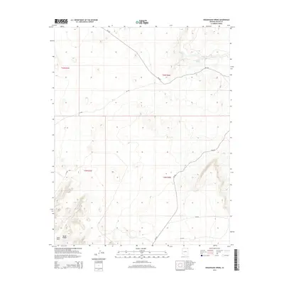
2014 Map of Hogansaani Spring
USGS Topo · Published 2014About this map
Rock Point serves as a primary point of interest in this high-desert landscape within the Chinle Valley. The map detail focuses on the essential water sources of the region, specifically Hogansaani Spring and the drainage of Walker Cr, which define the local topography. This area is crisscrossed by Bureau of Indian Affairs routes, including Bia-5054 and Bia-N35, reflecting the modern infrastructure and connectivity within the Shiprock Agency. The terrain is characterized by the broad valley floor and significant elevation changes marked across the township lines of T40N and T39N. The reliance on these specific springs and creek beds highlights the historical and geographic importance of water management in this arid part of Apache County.
Find a feature on this map
16 named features on this map. Tap any name to fly to it.
Don’t see what you’re looking for? This feature index may not catch every label — zoom into the map to look around manually.
Map Details
Editions of this 2014 Hogansaani Spring Map
This is the sole edition of this map. No revisions or reprints were ever made.
Other maps of this area

1892 · Canyon De Chelly
USGS Topo · 1:250,000

1953 · Los Gigantes NW
USGS Topo · 1:24,000

1953 · Dinne Mesa NW
USGS Topo · 1:24,000

1953 · Dinne Mesa SW
USGS Topo · 1:24,000

1953 · Toh-Atin Mesa
USGS Topo · 1:62,500

1953 · Los Gigantes Buttes
USGS Topo · 1:62,500

1954 · Shiprock
USGS Topo · 1:250,000

1958 · Shiprock
USGS Topo · 1:250,000

1959 · Shiprock
USGS Topo · 1:250,000
1968 · Mexican Water
USGS Topo · 1:24,000