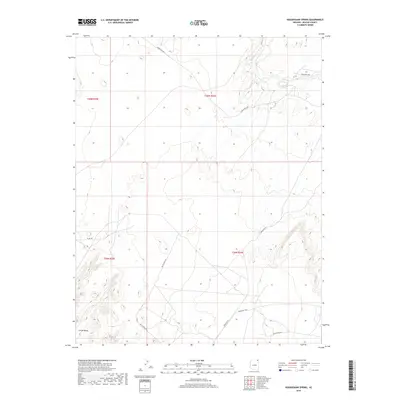
2018 Map of Hogansaani Spring
USGS Topo · Published 2018About this map
Chinle Valley defines the southern portion of this landscape, where the terrain transitions into a complex network of arid washes and seasonal drainages. Hogansaani Spring serves as a critical water source in the northeast, while the north-flowing Walker Cr provides a primary hydrological corridor. This 2018 survey reveals a modern transportation network composed largely of tribal and county routes, including Indian Rte 35 and Indian Rte 5040, which facilitate movement across the Shiprock Agency region. The road patterns, such as the winding path of Co Rd 484, follow the natural contours of the land, illustrating how access is maintained through the diverse elevations and geological structures of Apache County. This map documents a quiet, low-density settlement pattern centered on essential water points and established regional road corridors.
Find a feature on this map
14 named features on this map. Tap any name to fly to it.
Don’t see what you’re looking for? This feature index may not catch every label — zoom into the map to look around manually.
Map Details
Editions of this 2018 Hogansaani Spring Map
This is the sole edition of this map. No revisions or reprints were ever made.
Other maps of this area

1892 · Canyon De Chelly
USGS Topo · 1:250,000

1953 · Los Gigantes NW
USGS Topo · 1:24,000

1953 · Dinne Mesa NW
USGS Topo · 1:24,000

1953 · Dinne Mesa SW
USGS Topo · 1:24,000

1953 · Toh-Atin Mesa
USGS Topo · 1:62,500

1953 · Los Gigantes Buttes
USGS Topo · 1:62,500

1954 · Shiprock
USGS Topo · 1:250,000

1958 · Shiprock
USGS Topo · 1:250,000

1959 · Shiprock
USGS Topo · 1:250,000
1968 · Mexican Water
USGS Topo · 1:24,000