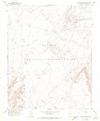
1968 Map of Hogansaani Spring
USGS Topo · Published 1971About this map
Hogansaani Spring and several other unnamed Springs provide critical water sources in this high-desert landscape of the Navajo Indian Reservation during the late 1960s. The topography is defined by the broad Chinle Valley and the winding drainage of Walker Creek, where the presence of a Cem and a Cliff Dwelling suggests long-standing habitation across different eras. Resource exploration is evident through a recorded Drill Hole in the western reaches of the quadrangle. The map documents a sparsely populated but geographically complex region, where scattered Spring labels and a solitary Water Tank reveal the essential infrastructure of life in the Arizona backcountry.
Find a feature on this map
11 named features on this map. Tap any name to fly to it.
Don’t see what you’re looking for? This feature index may not catch every label — zoom into the map to look around manually.
Map Details
Editions of this 1968 Hogansaani Spring Map
This is the sole edition of this map. No revisions or reprints were ever made.
Other maps of this area

1892 · Canyon De Chelly
USGS Topo · 1:250,000

1953 · Los Gigantes NW
USGS Topo · 1:24,000

1953 · Dinne Mesa NW
USGS Topo · 1:24,000

1953 · Dinne Mesa SW
USGS Topo · 1:24,000

1953 · Toh-Atin Mesa
USGS Topo · 1:62,500

1953 · Los Gigantes Buttes
USGS Topo · 1:62,500

1954 · Shiprock
USGS Topo · 1:250,000

1958 · Shiprock
USGS Topo · 1:250,000

1959 · Shiprock
USGS Topo · 1:250,000
1968 · Mexican Water
USGS Topo · 1:24,000