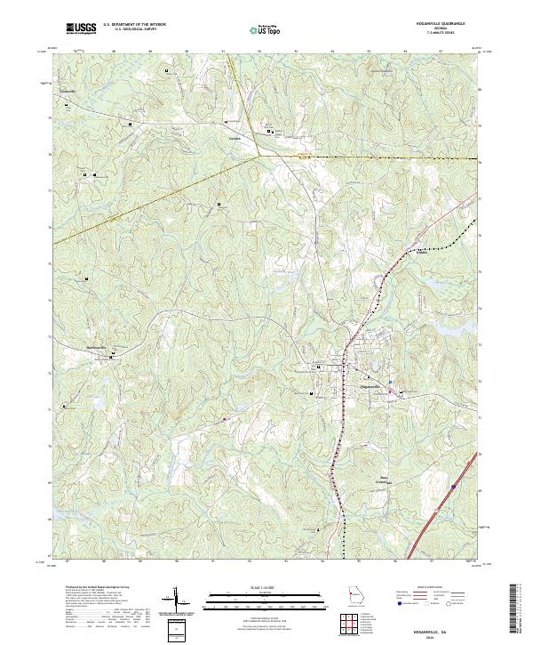
2024 Map of Hogansville
USGS Topo · Published 2024About this map
Hogansville serves as the focal point of this West Georgia landscape, situated where the CSX Transportation line cuts through Troup County. The settlement pattern reflects the area's agricultural and social history, with numerous family-named burial sites like Brown Cem and Reid Cem scattered throughout the rural hinterlands. The geography is defined by a series of creeks, notably Yellowjacket Creek and Potato Creek, which flow toward the southern reaches of West Point Lake. These waterways have long influenced the positioning of communities such as Corinth and Harrisonville. To the north, Dunbar Mountain provides a distinct topographic break in the otherwise undulating terrain. The inclusion of small crossroads and historical sites like Wadley Chapel and the Old Providence Cem makes this a primary resource for documenting local land use and community lineage in this corner of Troup, Coweta, and Heard counties.
Find a feature on this map
119 named features on this map. Tap any name to fly to it.
Don’t see what you’re looking for? This feature index may not catch every label — zoom into the map to look around manually.
Map Details
Editions of this 2024 Hogansville Map
This is the sole edition of this map. No revisions or reprints were ever made.
Other maps of this area

1899 · Wedowee
USGS Topo · 1:125,000

1902 · Wedowee
USGS Topo · 1:125,000

1953 · Atlanta
USGS Topo · 1:250,000

1957 · Atlanta
USGS Topo · 1:250,000

1958 · Atlanta
USGS Topo · 1:250,000

1964 · Hogansville
USGS Topo · 1:24,000
1964 · Mountville
USGS Topo · 1:24,000
1964 · La Grange
USGS Topo · 1:24,000

1964 · Hillcrest
USGS Topo · 1:24,000

1964 · Grantville
USGS Topo · 1:24,000