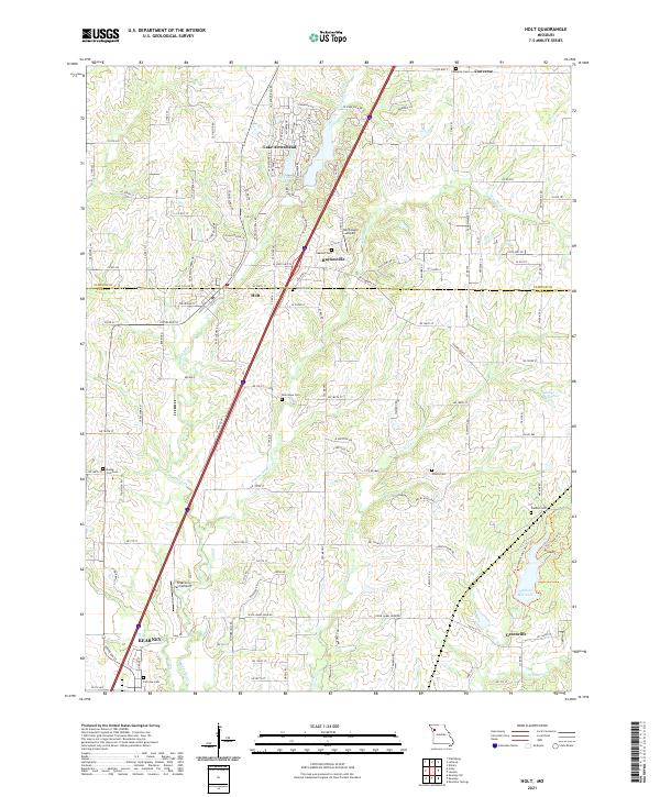
2021 Map of Holt
USGS Topo · Published 2021About this map
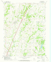
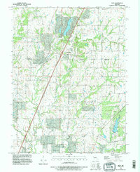
Kearney and Holt anchor this section of the Missouri landscape, where the Clinton Co Clay Co border divides the agricultural and residential terrain. The area is defined by a dense network of local cemeteries and family-linked landmarks, such as Jesse James Farm Rd and Watkins Mill Lake. Tributaries of the Muddy Fork and Carroll Cr wind through the hills, punctuated by small aviation sites like Northwood Airport and Peterson Farm Airport. The map highlights the transition from the small town centers of Haynesville and Greenville to the surrounding rural reaches. The distribution of sites like Antioch Cem and New Hope Cem provides a clear spatial record of early settlement patterns and community centers within Clay and Clinton Counties during the early 21st century.
Find a feature on this map
56 named features on this map. Tap any name to fly to it.
Don’t see what you’re looking for? This feature index may not catch every label — zoom into the map to look around manually.
Map Details
Editions of this 2021 Holt Map
This is the sole edition of this map. No revisions or reprints were ever made.