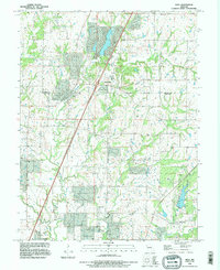
1990 Map of Holt
USGS Topo · Published 1995About this map
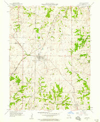
The boundary between Clinton and Clay counties cuts through this Missouri landscape, with the town of Holt serving as a central point of reference. Revised from imagery captured in the early 1990s, the map reveals a countryside defined by deep creek valleys, including the Muddy Fork and Clear Creek. The area preserves significant local heritage through landmarks like the James Farm County Park and Watkins State Park in the southeast. Numerous family and community burial grounds are documented across the terrain, from Converse Cem in the north to Fairview Cem near the southern border. Smaller settlements like Haynesville and Converse appear as established rural clusters, while the drainage patterns of New Hope Creek and Carroll Creek illustrate the natural topography that shaped the region's early road networks and farm placements.
Find a feature on this map
22 named features on this map. Tap any name to fly to it.
Don’t see what you’re looking for? This feature index may not catch every label — zoom into the map to look around manually.
Map Details
Editions of this 1990 Holt Map
This is the sole edition of this map. No revisions or reprints were ever made.
Other maps of this area

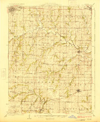
1894 · Independence
USGS Topo · 1:125,000
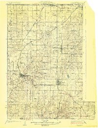
1924 · Polo
USGS Topo · 1:62,500
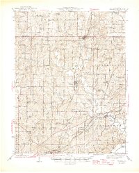
1925 · Plattsburg
USGS Topo · 1:62,500

1936 · Kearney
USGS Topo · 1:48,000

1942 · Kearney
USGS Topo · 1:62,500
1945 · Kearney
USGS Topo · 1:62,500

1950 · Kansas City
USGS Topo · 1:250,000

1954 · Kansas City
USGS Topo · 1:250,000

1956 · Kansas City
USGS Topo · 1:250,000
1957 · Lawson
USGS Topo · 1:24,000