
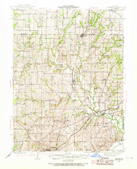
1942 Map of Kearney
USGS Topo · Published 1965About this map
The town of Kearney serves as a central hub in this mid-century portrait of Clay County, Missouri, where a network of rural schools and churches defines the social landscape. Educational centers such as Mt Gilead Sch, Prairie Home Sch, and Lunsford Sch are scattered across the terrain, reflecting the distributed settlement patterns of the era. To the south, the Fishing River and Little Shoal Creek carve through the countryside near the growing community of Liberty.
Find a feature on this map
63 named features on this map. Tap any name to fly to it.
Don’t see what you’re looking for? This feature index may not catch every label — zoom into the map to look around manually.
Map Details
Editions of this 1942 Kearney Map
2 editions found
Other maps of this area

1890 · Kansas City
USGS Topo · 1:125,000

1894 · Kansas City
USGS Topo · 1:125,000

1894 · Independence
USGS Topo · 1:125,000

1914 · Smithville
USGS Topo · 1:62,500

1924 · Polo
USGS Topo · 1:62,500

1925 · Gower
USGS Topo · 1:62,500

1925 · Plattsburg
USGS Topo · 1:62,500

1935 · Buckner
USGS Topo · 1:24,000

1935 · Missouri City
USGS Topo · 1:24,000

1935 · North Kansas City
USGS Topo · 1:24,000