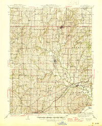
1945 Map of Kearney
USGS Topo · Published 1945About this map
Kearney and the surrounding Clay and Clinton County landscapes are defined here by a dense network of rural school districts and small rail-stop settlements. The topographic survey, overseen by state geologist Edward L. Clark, reveals how deeply the drainage of the Fishing River and Little Shoal River shaped early development. Three major rail lines, including the Chicago Burlington and Quincy, cut through the hills, connecting towns like Holt and Mosby to the larger region. For genealogists, the map is a remarkable record of rural social centers, documenting dozens of named schools such as Mt Gilead Sch, Oakland Sch, and Prairie Home Sch, alongside spiritual landmarks like Antioch Ch and New Hope Ch. The southeastern corner shows the lowlands near Cooley Lake, illustrating the transition from rolling upland farms to the river valley flats.
Find a feature on this map
79 named features on this map. Tap any name to fly to it.
Don’t see what you’re looking for? This feature index may not catch every label — zoom into the map to look around manually.
Map Details
Editions of this 1945 Kearney Map
2 editions found

Other maps of this area

1890 · Kansas City
USGS Topo · 1:125,000

1894 · Kansas City
USGS Topo · 1:125,000

1894 · Independence
USGS Topo · 1:125,000

1914 · Smithville
USGS Topo · 1:62,500

1924 · Polo
USGS Topo · 1:62,500

1925 · Gower
USGS Topo · 1:62,500

1925 · Plattsburg
USGS Topo · 1:62,500

1935 · Buckner
USGS Topo · 1:24,000

1935 · Missouri City
USGS Topo · 1:24,000

1935 · North Kansas City
USGS Topo · 1:24,000