
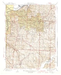
1935 Map of Missouri City
USGS Topo · Published 1935About this map
The Missouri River cuts a wide path through this mid-1930s landscape, defining the border between Clay and Jackson counties. On the north bank, Missouri City sits tucked against the bluffs along the Wabash line, while the southern floodplain is dominated by the agricultural settlement of Atherton and the meandering course of the Little Blue River. This survey reveals a deeply established rural infrastructure of small district schools, such as Hunt Sch, Blue Valley Sch, and Sharp Sch, which served the farming families scattered across the river bends and uplands.
Find a feature on this map
22 named features on this map. Tap any name to fly to it.
Don’t see what you’re looking for? This feature index may not catch every label — zoom into the map to look around manually.
Map Details
Editions of this 1935 Missouri City Map
This is the sole edition of this map. No revisions or reprints were ever made.
Other maps of this area

1894 · Independence
USGS Topo · 1:125,000

1933 · Blue Springs
USGS Topo · 1:24,000

1934 · Oak Grove
USGS Topo · 1:24,000

1934 · Independence
USGS Topo · 1:24,000

1935 · Buckner
USGS Topo · 1:24,000

1935 · Liberty
USGS Topo · 1:24,000

1936 · Kearney
USGS Topo · 1:48,000

1940 · Liberty
USGS Topo · 1:31,680
1940 · Independence
USGS Topo · 1:31,680

1942 · Kearney
USGS Topo · 1:62,500