
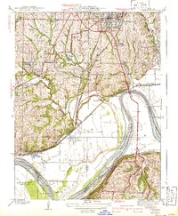
1940 Map of Liberty
USGS Topo · Published 1940About this map
Liberty serves as a prominent regional hub in the late 1930s, anchored by the campus of William Jewell College and the large Odd Fellows Home complex. The landscape is defined by the sharp convergence of multiple major rail lines including the Wabash, Missouri Pacific, and the Atchison Topeka and Santa Fe, which navigate the rugged bluffs above the Missouri River. Industrial and social markers of the era are visible in features like the Federal Transient Camp near Shoal Creek and the riverfront operations at Cement City. This survey captures the transition from rural clay hills to an intensifying industrial corridor, where small settlements like Birmingham and Minneville sit nestled between the river bends and the expanding infrastructure of Kansas City. Rural life remains etched in the land through family-named school districts such as Withers Sch and Ewing Sch.
Find a feature on this map
50 named features on this map. Tap any name to fly to it.
Don’t see what you’re looking for? This feature index may not catch every label — zoom into the map to look around manually.
Map Details
Editions of this 1940 Liberty Map
2 editions found
Other maps of this area

1890 · Kansas City
USGS Topo · 1:125,000

1894 · Kansas City
USGS Topo · 1:125,000

1894 · Independence
USGS Topo · 1:125,000

1914 · Smithville
USGS Topo · 1:62,500

1933 · Blue Springs
USGS Topo · 1:24,000

1934 · Independence
USGS Topo · 1:24,000

1935 · Kansas City
USGS Topo · 1:24,000

1935 · Missouri City
USGS Topo · 1:24,000

1935 · North Kansas City
USGS Topo · 1:24,000

1935 · Liberty
USGS Topo · 1:24,000