
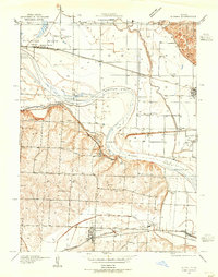
1935 Map of Buckner
USGS Topo · Published 1935About this map
The Missouri River dominates this mid-1930s landscape, winding through a complex series of bends including Jackass Bend, Little Blue Bend, and Sibley Bend. The terrain is sharply divided between the wide, fertile river bottomlands to the north and the high, dissected bluffs of Fort Osage to the south. This era shows a region heavily reliant on rail transportation, with the Atchison Topeka and Santa Fe and the Wabash RR cutting across the floodplains, while the Missouri Pacific Line serves the southern settlements.
Find a feature on this map
35 named features on this map. Tap any name to fly to it.
Don’t see what you’re looking for? This feature index may not catch every label — zoom into the map to look around manually.
Map Details
Editions of this 1935 Buckner Map
2 editions found
Other maps of this area

1894 · Independence
USGS Topo · 1:125,000

1933 · Blue Springs
USGS Topo · 1:24,000

1934 · Oak Grove
USGS Topo · 1:24,000

1935 · Missouri City
USGS Topo · 1:24,000

1936 · Kearney
USGS Topo · 1:48,000

1942 · Kearney
USGS Topo · 1:62,500

1945 · Kearney
USGS Topo · 1:62,500
1945 · Blue Springs
USGS Topo · 1:24,000
1945 · Missouri City
USGS Topo · 1:24,000
1947 · Blue Springs
USGS Topo · 1:31,680