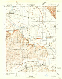
1935 Map of Buckner
USGS Topo · Published 1955About this map
Fort Osage anchors the southern bluffs above the Missouri River in this mid-1930s survey of the Jackson County borderlands. The landscape is defined by the heavy meanders of the river, which carves distinct oxbows and points including Jackass Bend and Sibley Bend. The river serves as a major dividing line between the high, broken ground to the south and the broad alluvial plains of the north, where the Fishing River joins the main channel.
Find a feature on this map
43 named features on this map. Tap any name to fly to it.
Don’t see what you’re looking for? This feature index may not catch every label — zoom into the map to look around manually.
Map Details
Editions of this 1935 Buckner Map
2 editions found
Other maps of this area

1894 · Independence
USGS Topo · 1:125,000

1933 · Blue Springs
USGS Topo · 1:24,000

1934 · Oak Grove
USGS Topo · 1:24,000

1935 · Buckner
USGS Topo · 1:24,000

1935 · Missouri City
USGS Topo · 1:24,000

1936 · Kearney
USGS Topo · 1:48,000

1942 · Kearney
USGS Topo · 1:62,500

1945 · Kearney
USGS Topo · 1:62,500
1945 · Blue Springs
USGS Topo · 1:24,000
1945 · Missouri City
USGS Topo · 1:24,000