2024 Map of Homestead
USGS Topo · Published 2024About this map
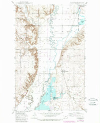
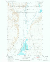
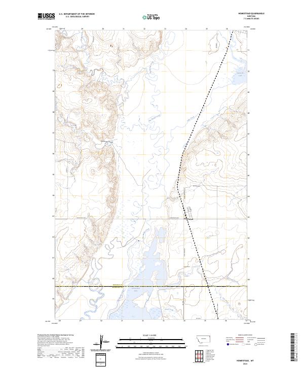
Big Muddy Creek meanders through the heart of this Sheridan County landscape, defining the hydrology and land use near the small settlement of Homestead. The area is characterized by significant conservation zones, with the Medicine Lake National Wildlife Refuge and Sheridan County Waterfowl Production Area preserving the wetlands and prairie potholes essential for migratory birds. To the south, the boundary between Sheridan and Roosevelt Counties crosses through Homestead Lake, while the waters of Medicine Lake occupy the northeastern corner. The local road network, including the Homestead Hwy, Section Ave, and Charlesworth Ave, follows the traditional section lines of the Public Land Survey System, providing access to the coulees and creek beds like Sauerkraut Coulee and Wolf Creek that drain this high plains region.
Find a feature on this map
26 named features on this map. Tap any name to fly to it.
Don’t see what you’re looking for? This feature index may not catch every label — zoom into the map to look around manually.
Map Details
Editions of this 2024 Homestead Map
This is the sole edition of this map. No revisions or reprints were ever made.
Historical Maps of Fort Kipp District Through Time
4 maps found