2023 Map of Hookstown
USGS Topo · Published 2023About this map
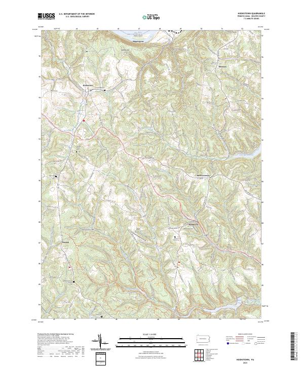
Shippingport and Hookstown anchor this portion of Beaver County along the southern bank of the Ohio River, where the landscape transitions from industrial riverfront to the protected woodlands of Raccoon Creek State Park. The map documents a high density of rural cemeteries and parish sites, including Old Mill Creek Cem, Hanover Church Cem, and the Bethel Methodist Church, which serve as vital landmarks for local genealogical research. In the south, the extensive Raccoon Creek State Park Trails Trl network winds through the valley of Traverse Creek, leading toward Main Lake and the Group Camping Area Lake. The presence of small aviation facilities like McCoy Airport and Hanny Beaver Airpark Inc reflects the region's specialized transportation infrastructure, while the Ambridge Reservoir on Service Creek highlights the area's role in local water management and resource conservation.
Find a feature on this map
104 named features on this map. Tap any name to fly to it.
Don’t see what you’re looking for? This feature index may not catch every label — zoom into the map to look around manually.
Map Details
Editions of this 2023 Hookstown Map
This is the sole edition of this map. No revisions or reprints were ever made.
Historical Maps of Harshaville Through Time
Featured Locations
- Raccoon Township, PA
- Hookstown, PA
- Harshaville, Hanover Township
- Kendall, Hanover Township
- Mechanicsburg, Raccoon Township