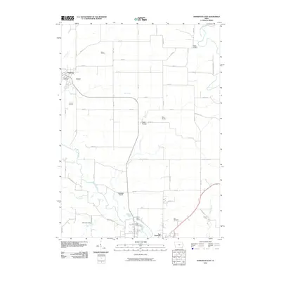
2010 Map of Hopkinton East
USGS Topo · Published 2010About this map
The Maquoketa River and its several tributaries, including Silver Creek and Cline Creek, define the landscape of eastern Delaware and Jones Counties in this 2010 survey. The settlement of Hopkinton sits along the northwestern edge of the map, featuring the Hopkinton Post Office and nearby Hopkinton Cemetery. This region is particularly rich in family and community history, evidenced by a high density of burial grounds like Willard Cemetery, Livingston Cemetery, and Mount Pleasant Cemetery.
Find a feature on this map
59 named features on this map. Tap any name to fly to it.
Don’t see what you’re looking for? This feature index may not catch every label — zoom into the map to look around manually.
Map Details
Editions of this 2010 Hopkinton East Map
This is the sole edition of this map. No revisions or reprints were ever made.
Other maps of this area

1890 · Anamosa
USGS Topo · 1:62,500

1891 · Monticello
USGS Topo · 1:62,500

1900 · Anamosa
USGS Topo · 1:125,000

1959 · Dubuque
USGS Topo · 1:250,000

1961 · Dubuque
USGS Topo · 1:250,000

1962 · Dubuque
USGS Topo · 1:250,000
1965 · Dyersville West
USGS Topo · 1:24,000
1965 · Dyersville East
USGS Topo · 1:24,000

1966 · Hopkinton East
USGS Topo · 1:24,000
1966 · Cascade
USGS Topo · 1:24,000