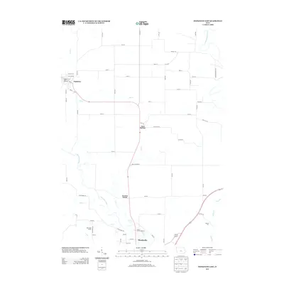
2013 Map of Hopkinton East
USGS Topo · Published 2013About this map
Monticello anchors the southern edge of this Jones County landscape, where the Maquoketa River winds through a valley defined by significant water crossings and rural junctions. The map documents a corridor of small settlements and transit points including Sand Springs and the aptly named Junction Switch, illustrating the late-twentieth-century rural infrastructure before further modernization. Northward, Hopkinton sits near the Sand Cr confluence, featuring local landmarks like the Highway Thirty-Eight Speedway.
Find a feature on this map
64 named features on this map. Tap any name to fly to it.
Don’t see what you’re looking for? This feature index may not catch every label — zoom into the map to look around manually.
Map Details
Editions of this 2013 Hopkinton East Map
This is the sole edition of this map. No revisions or reprints were ever made.
Other maps of this area

1890 · Anamosa
USGS Topo · 1:62,500

1891 · Monticello
USGS Topo · 1:62,500

1900 · Anamosa
USGS Topo · 1:125,000

1959 · Dubuque
USGS Topo · 1:250,000

1961 · Dubuque
USGS Topo · 1:250,000

1962 · Dubuque
USGS Topo · 1:250,000
1965 · Dyersville West
USGS Topo · 1:24,000
1965 · Dyersville East
USGS Topo · 1:24,000

1966 · Hopkinton East
USGS Topo · 1:24,000
1966 · Cascade
USGS Topo · 1:24,000