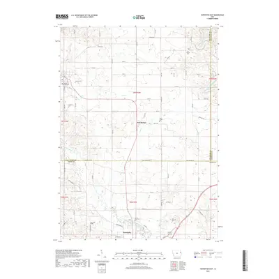
2018 Map of Hopkinton East
USGS Topo · Published 2018About this map
The Maquoketa River carves through this agricultural landscape at the border of Delaware, Dubuque, and Jones Counties. The small community of Sand Springs sits centrally, surrounded by numerous historic burial grounds including Willard Cem, Livingston Cem, and Sand Springs Cem. Further south, the map reaches the northern edge of Monticello, where the Sacred Heart Cem and East Monticello Cem are situated near the riverbanks. This area is defined by a dense grid of rural roads and numerous watercourses like Silver Cr, Cline Cr, and Bell Cr. For local historians and genealogists, the map provides precise locations for family-named landmarks and the Wet Creek Bridge, illustrating the settlement patterns and infrastructure connecting these eastern Iowa townships.
Find a feature on this map
65 named features on this map. Tap any name to fly to it.
Don’t see what you’re looking for? This feature index may not catch every label — zoom into the map to look around manually.
Map Details
Editions of this 2018 Hopkinton East Map
This is the sole edition of this map. No revisions or reprints were ever made.
Other maps of this area

1890 · Anamosa
USGS Topo · 1:62,500

1891 · Monticello
USGS Topo · 1:62,500

1900 · Anamosa
USGS Topo · 1:125,000

1959 · Dubuque
USGS Topo · 1:250,000

1961 · Dubuque
USGS Topo · 1:250,000

1962 · Dubuque
USGS Topo · 1:250,000
1965 · Dyersville West
USGS Topo · 1:24,000
1965 · Dyersville East
USGS Topo · 1:24,000

1966 · Hopkinton East
USGS Topo · 1:24,000
1966 · Cascade
USGS Topo · 1:24,000