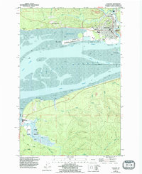
1957 Map of Hoquiam
USGS Topo · Published 1957About this map
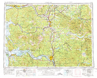
The industrial and riverine character of Southwest Washington is clearly defined in this mid-century survey, centered on the heavy timber and shipping hubs at Grays Harbor. Rail lines including the Northern Pacific and Grays Harbor Pacific connect coastal ports like Hoquiam and Aberdeen to the inland agricultural and coal centers of Centralia and Chehalis. To the south, the Columbia River serves as the primary boundary and artery, showing the established communities of Cathlamet and Longview before the modern interstate system fully reshaped the region.
Find a feature on this map
214 named features on this map. Tap any name to fly to it.
Don’t see what you’re looking for? This feature index may not catch every label — zoom into the map to look around manually.
Map Details
Editions of this 1957 Hoquiam Map
This is the sole edition of this map. No revisions or reprints were ever made.
Historical Maps of Lacey Through Time
6 maps found