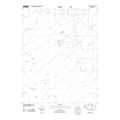
2011 Map of Horn Peak
USGS Topo · Published 2011About this map
Tanglewood Acres and the residential enclaves along the edge of the Wet Mountain Valley mark a transition between high alpine peaks and the open Prairie Reiser. This 2011 topographic survey documents a landscape defined by dramatic vertical relief, where several major summits of the Sangre de Cristo Range—including Horn Peak, Comanche Peak, and Mount Adams—rise sharply above the valley floor. The map traces the complex hydrology of the eastern slope, showing the descent of Venable Creek, Alvarado Creek, and Cottonwood Creek through steep canyons. Local history and recreation are centered around the Alvarado Picnic Ground and the Horn Creek Ranch, while backcountry features such as Venable Falls and the remote Macey Lake indicate the character of the high wilderness. The road network, including Hermit Rd and Shining Mountain Rd, serves as the primary access to the trailheads and seasonal lodges like Abbots Lodge that dot the mountain base.
Find a feature on this map
63 named features on this map. Tap any name to fly to it.
Don’t see what you’re looking for? This feature index may not catch every label — zoom into the map to look around manually.
Map Details
Editions of this 2011 Horn Peak Map
This is the sole edition of this map. No revisions or reprints were ever made.
Other maps of this area

1889 · Canon City
USGS Topo · 1:125,000

1889 · Huerfano Park
USGS Topo · 1:125,000

1892 · Huerfano Park
USGS Topo · 1:125,000

1892 · Canon City
USGS Topo · 1:125,000

1954 · Trinidad
USGS Topo · 1:250,000

1954 · Pueblo
USGS Topo · 1:250,000

1955 · Westcliffe
USGS Topo · 1:24,000

1955 · Trinidad
USGS Topo · 1:250,000

1957 · Pueblo
USGS Topo · 1:250,000

1957 · Aldrich Gulch
USGS Topo · 1:24,000