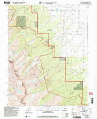
2001 Map of Horn Peak
USGS Topo · Published 2005About this map
The Sangre de Cristo Range dominates this 2001 revision, where the dramatic elevation change from the Wet Mountain Valley to the high alpine peaks is clearly defined. The area is a network of water and wilderness, featuring high-altitude catchments like North Crestone Lake, Macey Lake, and Venable Lakes that feed numerous creeks descending toward the valley floor. The map documents the interface between protected public lands and private development, showing Tanglewood Acres and Horn Creek Ranch nestled at the forest edge. Notable landmarks such as Horn Peak, Mount Adams, and Phantom Terrace define the ridgeline, while the Rainbow Trail and Venable Trail provide historic transit through the Sangre de Cristo Wilderness. This survey reflects the modern management of the San Isabel National Forest, capturing the location of the Conquistador Ski Area and various ranger district boundaries.
Find a feature on this map
54 named features on this map. Tap any name to fly to it.
Don’t see what you’re looking for? This feature index may not catch every label — zoom into the map to look around manually.
Map Details
Editions of this 2001 Horn Peak Map
This is the sole edition of this map. No revisions or reprints were ever made.
Other maps of this area

1889 · Canon City
USGS Topo · 1:125,000

1889 · Huerfano Park
USGS Topo · 1:125,000

1892 · Huerfano Park
USGS Topo · 1:125,000

1892 · Canon City
USGS Topo · 1:125,000

1954 · Trinidad
USGS Topo · 1:250,000

1954 · Pueblo
USGS Topo · 1:250,000

1955 · Westcliffe
USGS Topo · 1:24,000

1955 · Trinidad
USGS Topo · 1:250,000

1957 · Pueblo
USGS Topo · 1:250,000

1957 · Aldrich Gulch
USGS Topo · 1:24,000