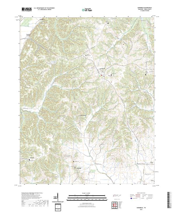
2022 Map of Hornbeak
USGS Topo · Published 2022About this map
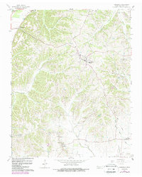
The small rural communities of Obion County are documented in this recent survey, centered on the historic town of Hornbeak and its surrounding agricultural landscape. The topography is defined by complex drainage systems such as Pawpaw Cr and Clover Creek, which carve out several named hollows like Gladys Hollow and Burnt Mill Hollow. Genealogists will find this sheet particularly valuable for its density of burial grounds, including the Antioch Baptist Cem and Thompson Cem, alongside more remote locations like Simpson Hill Cem.
Find a feature on this map
80 named features on this map. Tap any name to fly to it.
Don’t see what you’re looking for? This feature index may not catch every label — zoom into the map to look around manually.
Map Details
Editions of this 2022 Hornbeak Map
This is the sole edition of this map. No revisions or reprints were ever made.