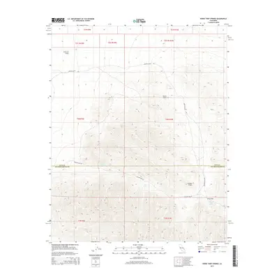
2015 Map of Horse Thief Springs
USGS Topo · Published 2015About this map
Horse Thief Springs provides a critical water source in the arid expanse along the Inyo and San Bernardino County line. This high-desert landscape is defined by the sharp elevations of the Kingston Range, which dominates the eastern half of the map and drops toward the lower reaches of California Valley. The network of vital springs, including Crystal Spring and Beck Spring, likely served as traditional stopovers for travelers navigating the difficult pass between mountain ranges. Historical access to this remote corner of the Mojave Desert is traced through rugged corridors like Excelsior Mine Rd and Mesquite Valley Rd, which follow the natural contours of the land. The topography here suggests a history of difficult transit, where high points like Tecopa Pass provided the only practical passage through the steep terrain.
Find a feature on this map
20 named features on this map. Tap any name to fly to it.
Don’t see what you’re looking for? This feature index may not catch every label — zoom into the map to look around manually.
Map Details
Editions of this 2015 Horse Thief Springs Map
This is the sole edition of this map. No revisions or reprints were ever made.
Other maps of this area

1910 · Ivanpah
USGS Topo · 1:250,000

1912 · Ivanpah
USGS Topo · 1:250,000

1933 · Avawatz Mountains
USGS Topo · 1:250,000

1942 · Ivanpah
USGS Topo · 1:250,000

1947 · Trona
USGS Topo · 1:250,000

1947 · Kingman
USGS Topo · 1:250,000

1948 · Kingman
USGS Topo · 1:250,000

1948 · Trona
USGS Topo · 1:250,000

1950 · Tecopa
USGS Topo · 1:62,500

1951 · Tecopa
USGS Topo · 1:62,500