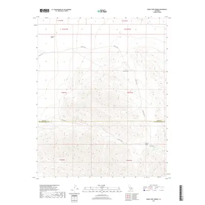
2018 Map of Horse Thief Springs
USGS Topo · Published 2018About this map
Horse Thief Springs anchors the southeastern corner of this arid landscape, where the high peaks of the Kingston Range meet the northern reaches of the Mojave Desert. This 2018 survey documents a remote corridor along the boundary of Inyo and San Bernardino counties, where water sources like Crystal Spring and Beck Spring provided essential stopovers for travelers navigating the difficult terrain. The map's network of unpaved tracks, including Excelsior Mine Rd and Mesquite Valley Rd, traces the historical movement of prospectors and miners through Tecopa Pass. North of the range, the topography opens into the California Valley, illustrating the stark transition between steep mountain slopes and broad desert basins that defined the logistics of early California mining and transit.
Find a feature on this map
11 named features on this map. Tap any name to fly to it.
Don’t see what you’re looking for? This feature index may not catch every label — zoom into the map to look around manually.
Map Details
Editions of this 2018 Horse Thief Springs Map
This is the sole edition of this map. No revisions or reprints were ever made.
Other maps of this area

1910 · Ivanpah
USGS Topo · 1:250,000

1912 · Ivanpah
USGS Topo · 1:250,000

1933 · Avawatz Mountains
USGS Topo · 1:250,000

1942 · Ivanpah
USGS Topo · 1:250,000

1947 · Trona
USGS Topo · 1:250,000

1947 · Kingman
USGS Topo · 1:250,000

1948 · Kingman
USGS Topo · 1:250,000

1948 · Trona
USGS Topo · 1:250,000

1950 · Tecopa
USGS Topo · 1:62,500

1951 · Tecopa
USGS Topo · 1:62,500